
Currituck County is one of the oldest organized governments in North Carolina — older than the United States by more than a century. Carova Beach, the market this site exists to cover, is barely two human generations old. Both of those things are true at once, and this page is honest about the gap: it is not one continuous story told town by town, the way most county histories run. It is two histories, on two different clocks, that happen to share a county line.
Part One covers Currituck County itself — the 1668 precinct, the courthouse, the inlet that used to sit roughly where Carova's lots are platted today, and the lighthouse that still marks where the county's paved road ends. Part Two covers Carova Beach specifically — a 1967 investor subdivision, a federal flood-insurance line drawn in 1982, and a herd of wild horses that predates all of it. There is no "towns of the county" section here, because Carova is not one of several incorporated towns inside Currituck — it is a single unincorporated beach community, and Corolla, its nearest neighbor to the south, is a distinct place with its own history, not a Carova neighborhood.
1668 The Currituck Precinct
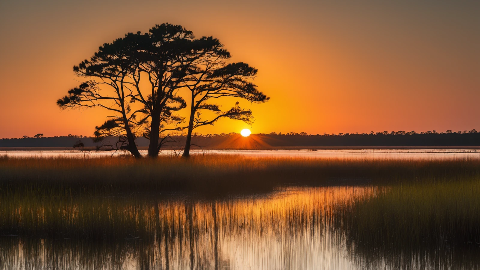
Currituck County was formed in 1668 from Albemarle County, taking its name from an Indian word generally translated as "land of the wild geese"1. It was one of four precincts the Lords Proprietors' colonial government organized out of the Albemarle region in the same era — Currituck, Pasquotank, Perquimans, and Chowan — making it, alongside those three, among the oldest units of organized government anywhere in what is now North Carolina.
The name itself has outlasted almost everything else from that founding. Wild geese still winter on Currituck Sound in real numbers; the county's own hunting-and-conservation identity, which runs through the Whalehead Club and the Currituck National Wildlife Refuge today, traces back to the same waterfowl the Algonquian name describes.
1739 County Status & the Courthouse
Currituck's 1668 formation made it a precinct, not yet a county in the modern legal sense — North Carolina's colonial precincts were formally reorganized into counties in 17392. NCpedia's own entry on the county states the 1668 formation date and stops there, without using the word "precinct" or dating the later county-status change; the 1739 date comes from a separate cross-check, not from NCpedia itself, and is presented here as an addition to that record rather than a correction of it.
The county seat has sat at the village of Currituck — on the mainland, not on the barrier-island sand where Carova sits — since at least the mid-eighteenth century. Records name a "Currituck Court House" there as early as 17553, and the village itself has never been formally incorporated, even as it kept functioning as the seat of county government for nearly three centuries. The Old Currituck County Courthouse and Jail still stands there today.
To the 1730s The Lost Currituck Inlet
One geographic fact ties the colonial precinct directly to the ground Carova occupies today. A navigable inlet — the Currituck Inlet — once connected Currituck Sound to the Atlantic Ocean at roughly the location of present-day Carova Beach. It closed sometime in the 1730s, the same decade the precincts around it were becoming counties4.
The inlet that once connected Currituck Sound to the Atlantic closed here in the 1730s — two centuries before anyone platted a lot on the sand that grew over it.
That closure is a large part of why this stretch of coast stayed empty for so long. Without a working inlet, the northern banks had no easy water access to the sound side and no reason for early settlement to reach this far north. The isolation that shapes a 4x4-only real estate market today has a documented eighteenth-century ancestor.
1875 The Currituck Beach Light
By the 1870s, the stretch of coast between Cape Henry Light in Virginia and Bodie Island Lighthouse to the south was the last dark gap in North Carolina's lighthouse coverage — forty miles with no warning light for passing ships. Construction on the Currituck Beach Lighthouse began in 1873, and the light was first lit on December 1, 18755. It was built of unpainted brick — deliberately left bare so mariners could tell it apart from its already-painted siblings up and down the coast — and stands in Corolla, a distinct town from Carova, five miles south of where Carova's own subdivision begins.
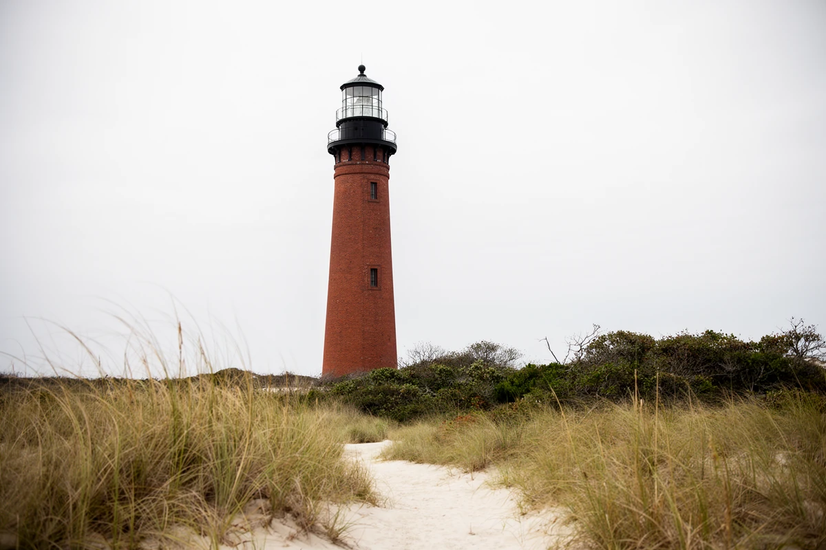
The Coast Guard automated the light in 1939. The federal government transferred title to Outer Banks Conservationists, Inc., a private nonprofit, in 2003, and the tower has been listed on the National Register of Historic Places since 1973. For a Carova buyer, the lighthouse matters for a more practical reason than its own history: it sits almost exactly at the point where the county's paved road, NC 12, stops.
1967–1970s Platting the Northern Banks
Development of Currituck's northern Outer Banks began in 1967, when an investment group from Sandbridge, Virginia — the last developed community across the state line — put together a plan to buy and subdivide the largely empty barrier-island land north of what is now Corolla6. The first subdivision platted out of that push was Carova itself: 1,993 individual lots, priced at roughly $8,000 apiece in the early 1970s. By 2006, comparable lots were changing hands for as much as $500,0007 — a real, documented price trajectory, not this site's own estimate.
The name given to that first subdivision is itself a piece of the geography: Carova is a portmanteau of "Carolina" and "Virginia," chosen because the community sits only about eleven miles south of the state line it borders8.
1984–Present Where the Pavement Ends
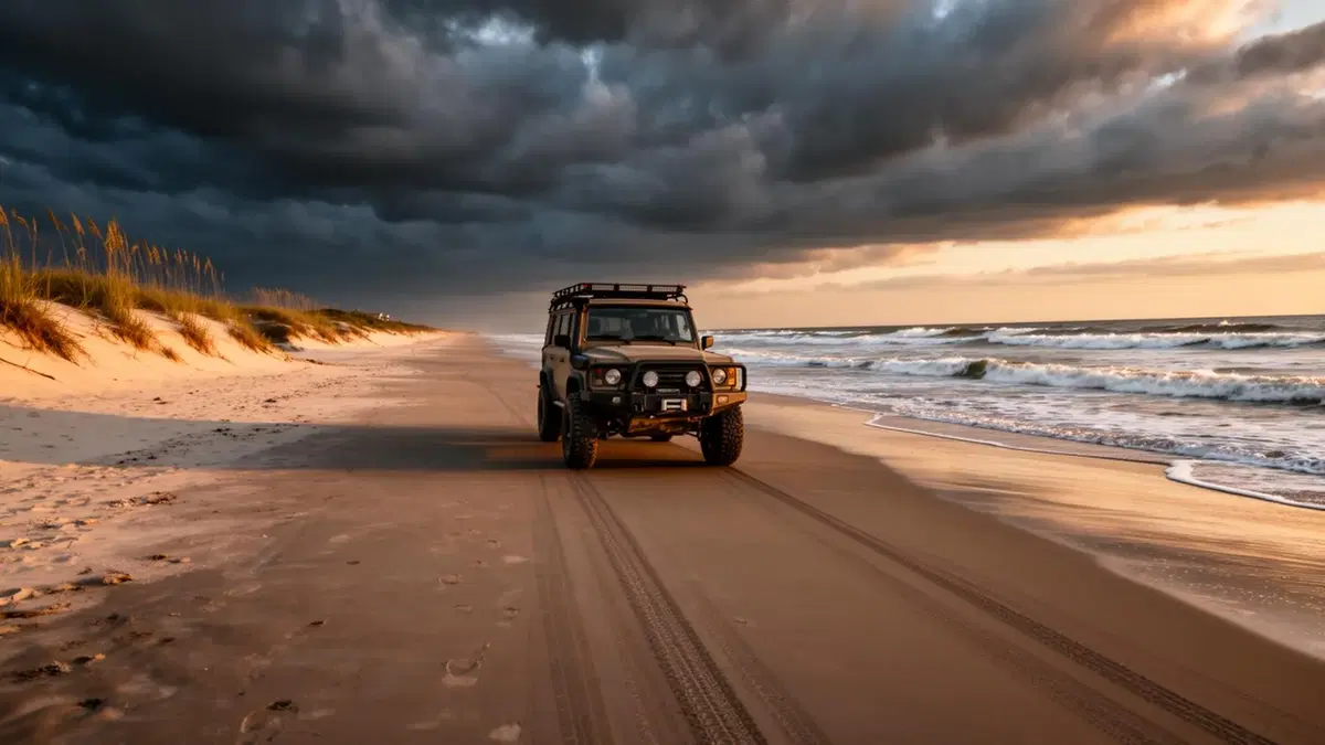
Corolla residents won a fight for a paved public access road from the south in 1984, and the state began extending NC 12 north to reach them the following year9. That paving stopped at Corolla. No paved road has ever been built connecting Corolla to Carova, Swan Beach, or North Swan Beach — the entire developed stretch north of the lighthouse remains accessible only by boat or by four-wheel-drive vehicle, driven along the open beach10.
The road stops at Corolla. The county line does not.
That is not a temporary gap waiting on a future budget cycle. It is the single fact this entire site's buyer's brief is organized around — the reason a Carova Beach purchase involves logistics, insurance, and financing decisions that a paved-road coastal market simply does not have to think about.
1982 The CBRS Line
Congress passed the Coastal Barrier Resources Act on October 18, 1982, creating the John H. Chafee Coastal Barrier Resources System and permanently withdrawing federal financial assistance — flood insurance, federally backed mortgages, federal road and utility funding, federal disaster aid — from the undeveloped coastal areas it designated11. Carova Beach's residential lots sit within CBRS Unit L01, one of two Currituck County units the U.S. Fish & Wildlife Service maintains here; the full framework of what that unit prohibits, and what it does not, is covered in this site's own Chapter 2, "The CBRS Premium."
The timing is worth sitting with. The 1967 investment group had already begun platting and selling Carova's lots for fifteen years before this designation existed. CBRS did not create Carova's isolation — the missing paved road and the missing inlet did that first — but it did permanently freeze the federal-financing picture around a subdivision that was already on the ground.
1989 The Wild Horses
The horses that range across Carova Beach today are widely described as descendants of Spanish Colonial mustangs left on this coast as far back as the sixteenth century12 — a lineage claim repeated consistently across regional conservation and tourism sources, though the exact date and mechanism of their arrival on this specific stretch of coast is not precisely documented and is not claimed here as settled fact. What is documented is more recent and more concrete: the same 1985 paving of NC 12 into Corolla that finally gave residents a public road also brought a highway through open horse range, and eleven horses were killed by vehicles on that stretch between 1985 and 198913.
The same highway that finally reached the herd killed eleven of its members in its first four years.
That toll is what led directly to the founding of the Corolla Wild Horse Fund in 1989, later incorporated as a nonprofit in 2001. A sea-to-sound fence separating the horses' range from the paved, populated area to the south was completed by 1997, running north to the Virginia state line. The organization's own account puts the accessible sanctuary at 7,544 acres; a separately sourced account puts the figure closer to 12,000 acres — the two numbers are not reconciled here, and are reported as found rather than picked between.
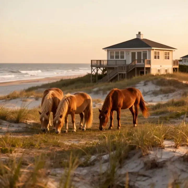
The fence's northern range runs directly through Carova and Swan Beach, not just Corolla — a stallion band can spend a week on a Carova lot and not reappear for two months, as this site's own Chapter 4 on coastal ecology covers in more detail. The herd is not a tourist backdrop confined to one town; it is a resident population of the same beach a buyer here owns a piece of.
Present Carova Today
Carova Beach today has roughly 50 year-round residents spread across around 740 rental-eligible homes14 — a population that small is itself a direct legacy of every fact above: no paved road, no municipal utility grid, a federal financing freeze older than most of the houses it applies to, and a fence line the county built to protect a herd that was here before any of it.
That is the honest shape of this page's two histories. Currituck County has been continuously governed for 358 years. Carova Beach, the specific market this site covers, has existed as a platted community for barely 59 of them — a young settlement inside one of North Carolina's oldest counties, on ground that spent two centuries as open water before anyone drew a lot line on it.
Primary Sources & Further Reading
The State Library of North Carolina's encyclopedia project. Source for the county's 1668 precinct-formation date and the origin of its name.
U.S. Fish & Wildlife Service — CBRA Program
The federal agency administering the Coastal Barrier Resources Act, and the source this site's own Chapter 2 already cites for Carova's Unit L01 designation.
The nonprofit's own published history — its 1989 founding, the 1985–1989 highway death toll that prompted it, and the sanctuary fence timeline.
NC State Historic Preservation Office
National Register of Historic Places documentation for the Currituck Beach Lighthouse (listed 1973).
Sources consulted for this page include NCpedia (the State Library of North Carolina's peer-reviewed encyclopedia project), the U.S. Fish & Wildlife Service's own CBRA program materials, the Corolla Wild Horse Fund's published organizational history, and Wikipedia-maintained articles on Currituck County, Carova Beach, Corolla, the Currituck Beach Lighthouse, and the Coastal Barrier Resources Act — used here for cross-checking specific dates and figures where no primary or NCpedia source was available, per this site's own sourcing standard, and never as the sole basis for a claim. Where sources genuinely disagree, as with the sanctuary's total acreage, this page states both figures rather than picking one silently. Numbered citations for specific claims appear below. Dates and figures are verified against these sources; nothing here is estimated or invented.
- Currituck County's 1668 formation "from Albemarle" and the county name's derivation from an Algonquian word meaning "land of the wild geese," per NCpedia's geography entry. NCpedia, "Currituck County," ncpedia.org/geography/currituck. ↩
- North Carolina's colonial precincts, including Currituck, were formally reorganized into counties in 1739 — a detail not present in NCpedia's own entry (as above) and drawn instead from the Wikipedia-maintained article on Currituck County, used here for cross-checking a date NCpedia does not state, not as a contradiction of it. en.wikipedia.org/wiki/Currituck_County,_North_Carolina. ↩
- The village of Currituck as county seat, with a "Currituck Court House" documented as early as 1755 and never formally incorporated, per the Wikipedia-maintained article on Currituck County (as above). ↩
- The historic Currituck Inlet, which connected Currituck Sound to the Atlantic near present-day Carova Beach and closed in the 1730s, per the Wikipedia-maintained article on Carova Beach. en.wikipedia.org/wiki/Carova_Beach,_North_Carolina. ↩
- Currituck Beach Lighthouse construction beginning in 1873 and first lighting on December 1, 1875, plus its 1939 automation, 1973 National Register listing, and 2003 transfer to Outer Banks Conservationists, Inc., per the Wikipedia-maintained article on the Currituck Beach Lighthouse. en.wikipedia.org/wiki/Currituck_Beach_Lighthouse. ↩
- Development of Currituck's northern Outer Banks beginning in 1967 with an investment group from Sandbridge, Virginia, per the Wikipedia-maintained article on Corolla, North Carolina. en.wikipedia.org/wiki/Corolla,_North_Carolina. ↩
- Carova as the first subdivision platted out of that 1967 push, with 1,993 lots priced at roughly $8,000 apiece in the early 1970s and reaching $500,000 by 2006, per the Wikipedia-maintained article on Corolla, North Carolina (as above). ↩
- "Carova" as a portmanteau of "Carolina" and "Virginia," reflecting the community's location roughly eleven miles south of the state line, per the Wikipedia-maintained article on Carova Beach (as above). ↩
- Corolla residents gaining a public paved access road from the south in 1984, with the state beginning to pave the NC 12 extension north the following year, per the Wikipedia-maintained article on Corolla, North Carolina (as above). ↩
- No paved road connects Corolla to Carova; access north of Corolla is by boat or four-wheel-drive vehicle along the open beach, per the Wikipedia-maintained articles on Carova Beach and Corolla, North Carolina (both as above), cross-checked against each other. ↩
- The Coastal Barrier Resources Act, signed October 18, 1982, creating the John H. Chafee Coastal Barrier Resources System, per the U.S. Fish & Wildlife Service's own CBRA program page and the Wikipedia-maintained article on the Coastal Barrier Resources Act, cross-checked against each other and against this site's own Chapter 2. U.S. Fish & Wildlife Service, "Coastal Barrier Resources Act," fws.gov/program/coastal-barrier-resources-act. ↩
- The horses' widely repeated Spanish Colonial descent, per the Wikipedia-maintained article on Corolla, North Carolina (as above) and regional conservation sources generally — presented here as a commonly cited lineage claim, not a precisely dated or independently verified fact, per this page's own sourcing standard. ↩
- The Corolla Wild Horse Fund's 1989 founding, its 2001 nonprofit incorporation, the eleven horses killed on NC 12 between 1985 and 1989, and the sea-to-sound sanctuary fence completed by 1997, per the Corolla Wild Horse Fund's own published history. Corolla Wild Horse Fund, "History," corollawildhorses.com/history. ↩
- Carova Beach's population of roughly 50 year-round residents against approximately 740 rental homes, per the Wikipedia-maintained article on Carova Beach (as above). ↩